DamPL11_a
Upper Lescar
SK 3321 8578
 looking SE,
from Endcliffe Park,
towards Hunters Bar & Sharrowvale Rd
 looking
N,
looking
N,
across Sharrowvale Rd
to start of unnamed alley
DamPL11_d
Upper Lescar
SK 3321 8578

looking E,
down unnamed alley, bounding dam site
 looking W,
up unnamed alley, bounding dam site

looking E,
down unnamed alley, bounding dam site

looking N,
across Sharrowvale Rd
to end of unnamed alley
It was located between Hunters Bar & Steel Road,
and was framed on the north side by what is now a stone lined alleyway, and on the south side by Sharrowvale Road
DamPL12_a
Lower Lescar
SK 3344 8576
 looking NE,
across Sharrowvale Rd
to Steel Rd & Meadow Terr.
DamPL12_d
Lower Lescar
SK 3344 8576

looking E,
across Steel Rd,
down Meadow Terr.

looking W,
up Meadow Terr.

looking W,
up Meadow Terr.

looking N,
across Sharrowvale Rd
up Meadow Terr.
It was located between Steel Road and Hickmott Road,
and was framed on the north side by what is now Meadow Terrace, on the south side by Sharrowvale Road
DamPL13_a
Sharrow Snuff Mill
top goit
SK 3362 8579


DamPL13_a
Sharrow Snuff Mill
top goit
further photos

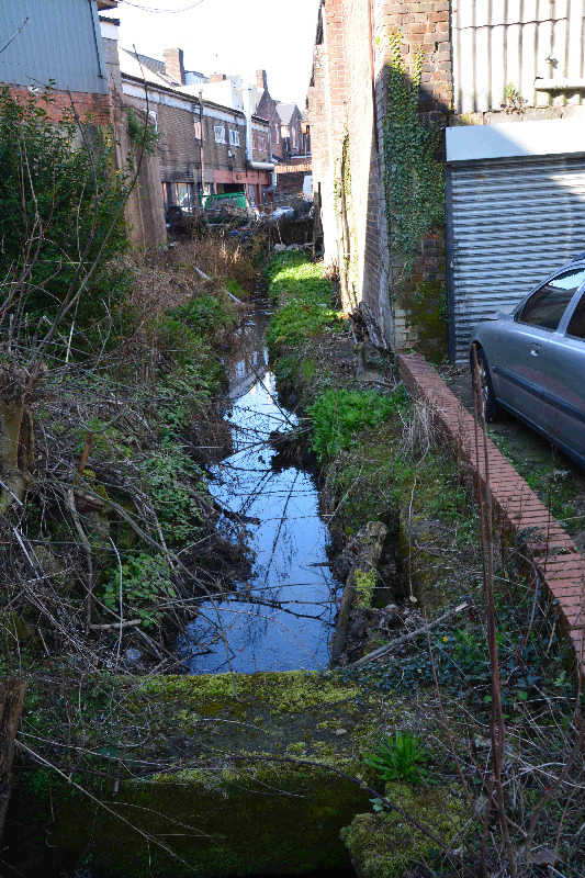


DamPL13_d
Sharrow Snuff Mill
the dam
SK 3388 8585


and the Mill itself is Grade II*listed, see Reference: 1247589
DamPL13_x
Sharrow Snuff Mill
the lower goit
SK 3388 8585


DamPL13_e
Sharrow Snuff Mill
overflow
SK 3396 8589


DamPL14_a
Stalker Wheel
top goit
SK 3399 8592


Notice deterioration in weir since 2006,
also large treestump washed down onto top RHS of weir (in Winter 2016?)

Flicker photo
by I M Barker 2006
DamPL14_d
approx site of
Stalker Wheel
Dam
SK 3399 8592
 looking N,
at Cemetery Ave & Stalker Lees Rd
 Looking SE
at Cemetery Ave, north side
 looking W from Stalker Walk,
to Stalker Lees Rd & Denham Rd
 looking W from Stalker Lees Rd,
to Harland Rd
DamPL14_x
Stalker Wheel
lower goit outflow
SK 3425 8607

DamPL15_a
Broomhall Wheel
top goit
SK 3428 8607


DamPL15_d
approx site of Broomhall Wheel
dam
SK 3428 8607
 looking W,
to cemetery & weir
 looking E,
along original line of Parliament Rd
 looking W,
across Summerfield St
 looking W,
from Cemetery Rd, across site of dam
DamPL15_w
approx site of Broomhall Wheel
Wheel
SK 3428 8607
 looking W,
from wheel site, now gym buildings
 looking NE,
towards wheel site, now gym buildings
approx site, under Gym building
DamPL16_a
Broomhall Mill
top goit
SK 3434 8611

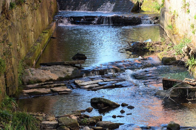
DamPL16_d
approx site of Broomhall Mill
Dam
SK 3434 8611
 looking E across Naipier St
 looking E
across Naipier St
looking E
across Naipier St
DamPL16_w
approx site of Broomhall Mill
Wheel
SK 3434 8611
 looking W from Cemetery Rd,
towards approx wheel site,
behind old Naiper works buildings
DamPL17w
approx site of
Norris Wheel
SK 3478 8632
 looking SE,
from St Mary's Gate,
looking SE,
from St Mary's Gate,
past Waitrose supermarket, to old bank
 looking W, from
old Ecclesall Rd,
looking W, from
old Ecclesall Rd,
past old bank, to Waitrose supermarket
 looking W,
from London Rd, to Waitrose supermarket
Site now underneath Waitrose supermarket
DamPL18_a
Bennett Wheel
top goit
SK 3498 8640


DamPL19_a
Sylvester Wheel
top goit
SK 3519 8642


DamPL20_a
Cinderhill Wheel
top goit
SK 3542 8653

